休暇村裏磐梯のブログページです。
![]()
全国の休暇村
JP
スタッフブログBLOG


観光
2023.06.25
[Fukushima] Jododaira trekking
1,106 view
スタッフ名:Niikura

I went trekking in Jododaira and Kamanuma on a precious sunny day between the rainy season.
This time we will introduce the latest situation with photos!
All photos were taken on June 17th.
This time we will introduce the latest situation with photos!
All photos were taken on June 17th.
What is Kamanuma?
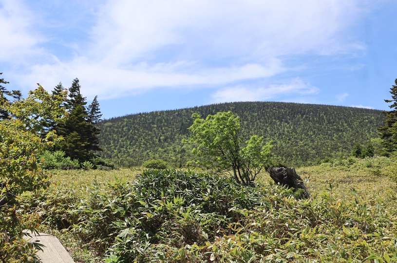
Located at an altitude of 1,770m, it is said that it got its name from its shape resembling a sickle. Starting and ending at the Jododaira Visitor Center, there is a walking course that goes around 5km (requires a little over 2 hours). The south side is a tundra-like grassland, and the north side is a wetland, where you can observe many alpine plants.
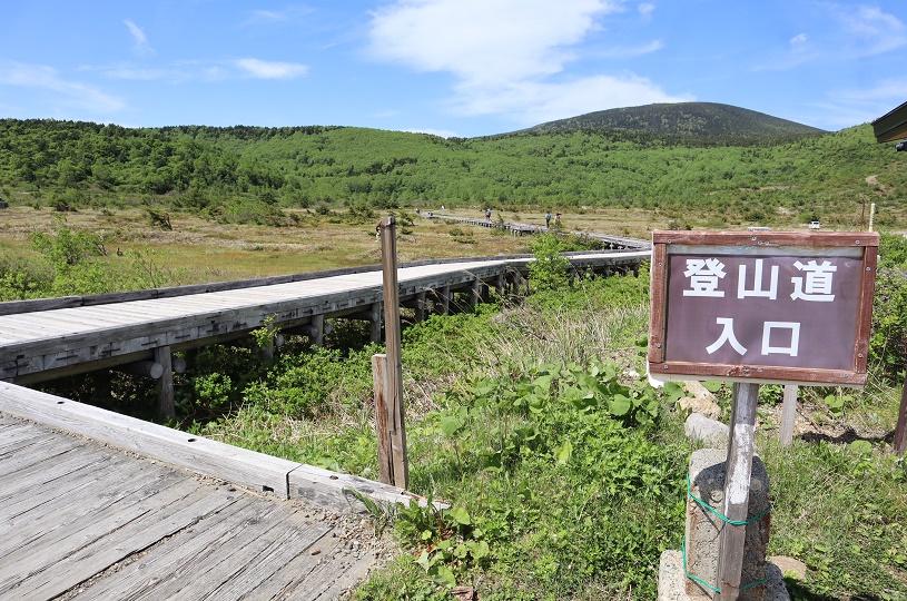
Enter the walking course next to the Jododaira Visitor Center.
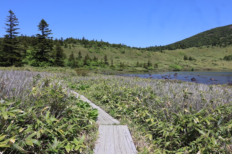
Although it is written as "mountain trail", first walk on the boardwalk.
Although it is written as "mountain trail", first walk on the boardwalk.
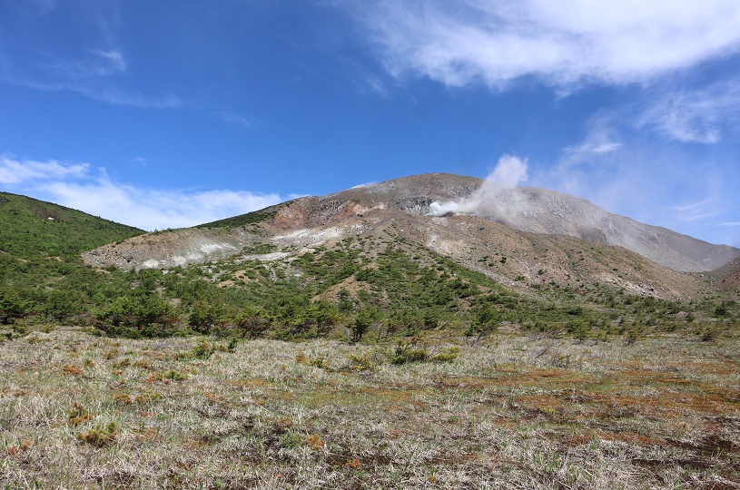
Azumayama Oana crater from the boardwalk.
What sounded like a jet plane was the sound of volcanic gas erupting from the crater...!
What sounded like a jet plane was the sound of volcanic gas erupting from the crater...!
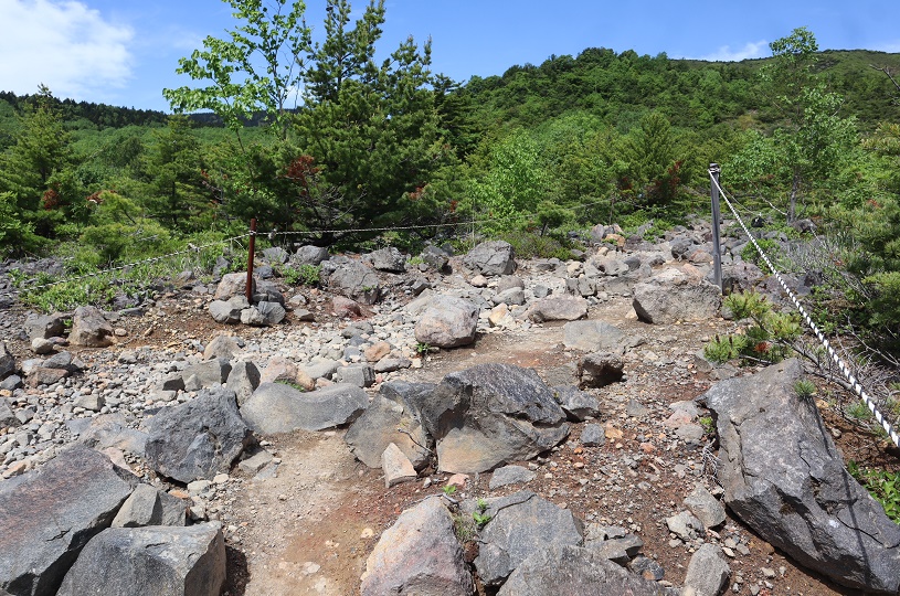
After passing the boardwalk, there is an uphill slope where stones and rocks stand out.
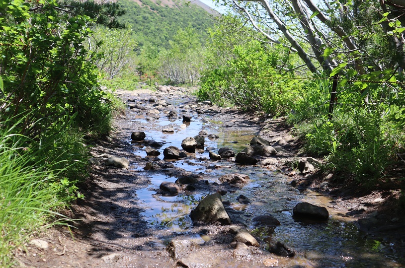
It had been raining until the day before, so it was like a stream here and there.
My shoes are all covered with mud...
It had been raining until the day before, so it was like a stream here and there.
My shoes are all covered with mud...
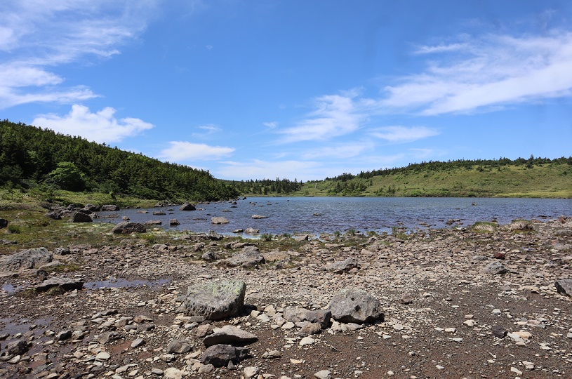
About 50 minutes from the Jododaira Visitor Center, we arrived at Kamanuma!
The area around Kamanuma has well-maintained wooden paths that make it easy to walk, and there are benches at scenic spots and along the waterfront. Many people were taking a break.
The area around Kamanuma has well-maintained wooden paths that make it easy to walk, and there are benches at scenic spots and along the waterfront. Many people were taking a break.
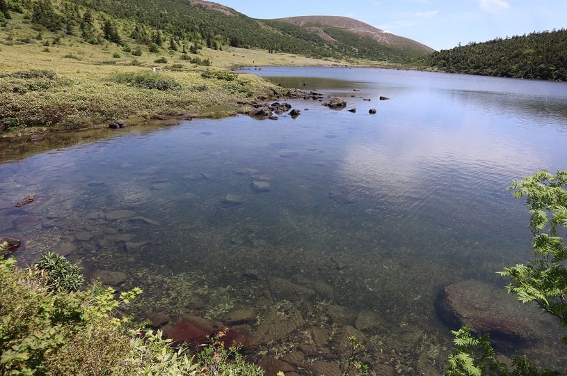
The surface of the water is clear !
Plants were seen on...
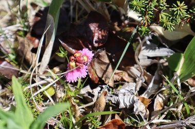
Fringed Galax
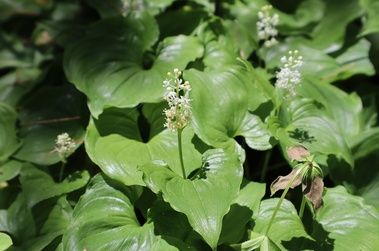
False lily of the valley
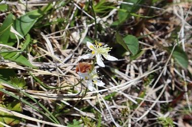
Coptis trifolia
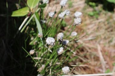
Cotton-sedge
*Don't forget to wear a bear bell when taking a walk.
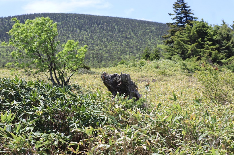
For a moment, I mistook a dead tree on the side of the walking course for a bear.
For a moment, I mistook a dead tree on the side of the walking course for a bear.
You can make a reservation from here. Single travelers are welcome!
Perfect for staying sightseeing! There is also a reasonable plan for consecutive nights. ↓↓↓
Perfect for staying sightseeing! There is also a reasonable plan for consecutive nights. ↓↓↓
Thank you for visiting Kyukamura Urabandai blog today.

Staff blog
スタッフのおすすめ情報をお届け♪
Follow フォロー


Ranking 直近30日の人気記事

251,138
ブログ
2021.07.05
湖、沼、池は何が違うの?自然現象解明シリーズ4

5,252
ブログ
2020.12.26
磐梯山ジオパークってご存じですか? ~まずはジオカレーから!

40,369
ブログ
2022.06.15
【2022年雄国沼湿原】ニッコウキスゲ最新開花情報
Archive 月別アーカイブ


休暇村一覧
![]()
〒110-8601東京都台東区東上野5-1-5 日新上野ビル5階
© 2026 KYUKAMURA All Rights Reserved.